


Abandoned Pa. Turnpikes


Thread Starter
Registered User
Joined: Apr 2011
Posts: 124
Abandoned Pa. Turnpikes
Heres something I came across, and thought you guys would find it as interesting and neat as I did... Who NEW !! .. ok maybe some of you did. LOL Michael http://www.bing.com/videos/search?q=...pike&FORM=VDRE
http://www.bing.com/videos/search?q=...pike&FORM=VDRE
 LoL
LoL

Registered User
Joined: Jun 2009
Posts: 15,192
From: southeastern Michigan
Good collection of videos.
I visited a couple of portions of the abandoned PA turnpike myself on my way to Fall Carlisle back in October.
Here's some photos I took. I brought my bike and rode along a good length of it. I didn't have the guts to go very far into the tunnel.


I visited a couple of portions of the abandoned PA turnpike myself on my way to Fall Carlisle back in October.
Here's some photos I took. I brought my bike and rode along a good length of it. I didn't have the guts to go very far into the tunnel.
Last edited by jaunty75; Jan 23, 2012 at 03:28 PM.

Registered User
Joined: Mar 2010
Posts: 1,309
From: South-central Pa.
Yes I've walked through a couple of them I think there's three.When they built the Pa TP.it was built on an abandon railroad that was never finished.Thats why it goes through the mountains instead of over them.It was the nations first super hyway paterened after the autobon in Germany.There was one tunnel through each mountain with 2 way traffic and no speed limit though 75 mph was posted.When they widened it back in the 70's they put a 2nd tunnel through each mountain some mountains it made more sense to go around or over so thats why there abandoned.
railguy
Oh yhea I live between two of the tunnels.It kind of local history for me.
railguy
Oh yhea I live between two of the tunnels.It kind of local history for me.

Registered User
Joined: Aug 2006
Posts: 3,145
From: Far Northeast Philadelphia, PA
I've heard about them, I just never knew where they were. There is also an optical illusion somewhere in teh 180's mile markers somewhere. It looks like you're going downhill, when you are really going uphill. You can only see it going westbound though. And the old church out around Somerset with the stairs that lead from the Turnpike, so the truckers could attend mass on Sundays.
I heard the reason they "closed" these tunnels is because the snow would be so heavy around there, it would actually snow the tunnel closed and the plows couldn't keep up. It would close down the turnpike a few times every winter.
Sideling Hill? That's before Midway going west, correct?
I heard the reason they "closed" these tunnels is because the snow would be so heavy around there, it would actually snow the tunnel closed and the plows couldn't keep up. It would close down the turnpike a few times every winter.
Sideling Hill? That's before Midway going west, correct?
Registered User
Joined: Nov 2006
Posts: 1,790
From: McMurray, PA
I love that stuff.... nice pics Jaunty. I've pulled over and investigated the first mile or so just east of Sideling Hill on foot before (it's a pretty safe place to pull over and back a car off the road), and I'm hoping to bike a lot of it this spring. I've heard that Chip Ganassi does (or did until recently) lease the Laurel Hill tunnel for use as a test wind tunnel for his various race teams.
Terry
Terry
Registered User
Joined: Mar 2010
Posts: 1,309
From: South-central Pa.
I heard the reason they "closed" these tunnels is because the snow would be so heavy around there, it would actually snow the tunnel closed and the plows couldn't keep up. It would close down the turnpike a few times every winter.
[/QUOTE]
When they widened it back in the 70's they put a 2nd tunnel through each mountain some mountains it made more sense to go around or over so thats why there abandoned.
railguy
[/QUOTE]
When they widened it back in the 70's they put a 2nd tunnel through each mountain some mountains it made more sense to go around or over so thats why there abandoned.
railguy
Registered User
Joined: Jun 2009
Posts: 15,192
From: southeastern Michigan
There are three abandoned tunnels, two of which can be accessed by the public. The Laurel Hill Tunnel apparently is used by the Pennsylvania Turpike Commission to store construction materials and equipment, and it is off-limits to the public. The Sideling Hill and Ray's Hill Tunnels are open. According to the various websites, they have been declared structurally safe.
The Sideling Hill Tunnel is over a mile long at 6,782 feet, and it is crowned in the middle to aid water drainage. Thus, when you're in the middle, you can't see either portal, and according to what I've read, if you want to experience total darkness, the middle of this tunnel is the place to do it.
The Ray's Hill Tunnel is about half as long at 3,532 feet, and you CAN see the end portals from the middle, so it's not completely dark in the daytime.
What I've read most often as to why they were abandonded is that they were huge traffic bottlenecks. The four-lane turnpike condensed to two lanes at the tunnels, and this caused large traffic backups at each end. As others have said, when the decision was made to make the turnpike four-lanes all the way through, they decided that going around the hills would be better than boring a second tube through each hill.
A lot of this and much more is detailed here:
http://abandonedturnpike.com/
The Sideling Hill Tunnel is over a mile long at 6,782 feet, and it is crowned in the middle to aid water drainage. Thus, when you're in the middle, you can't see either portal, and according to what I've read, if you want to experience total darkness, the middle of this tunnel is the place to do it.
The Ray's Hill Tunnel is about half as long at 3,532 feet, and you CAN see the end portals from the middle, so it's not completely dark in the daytime.
What I've read most often as to why they were abandonded is that they were huge traffic bottlenecks. The four-lane turnpike condensed to two lanes at the tunnels, and this caused large traffic backups at each end. As others have said, when the decision was made to make the turnpike four-lanes all the way through, they decided that going around the hills would be better than boring a second tube through each hill.
A lot of this and much more is detailed here:
http://abandonedturnpike.com/
Last edited by jaunty75; Jan 22, 2012 at 08:08 AM.

Registered User
Joined: Feb 2008
Posts: 11,798
From: Plano, TX
This is all cool info - thanks to everyone for sharing!
I have a thing about exploring old abandoned sites like these - looks like this will be on the list for when i make it up into that area! Good place to ride a bike, for sure.
EXCELLENT site - the videos are great - kinda like something I would do.
I have explored a good section of the old abandoned Hwy 101 in Oregon - that is disappearing very quickly. It is one you have to search and scrape for in the forest along the hiking trails.
I did find a big bridge built back in the 30's though.
I took some pics if and can post them if anyone is interested.
I have a thing about exploring old abandoned sites like these - looks like this will be on the list for when i make it up into that area! Good place to ride a bike, for sure.
A lot of this and much more is detailed here:
http://abandonedturnpike.com/
http://abandonedturnpike.com/
I have explored a good section of the old abandoned Hwy 101 in Oregon - that is disappearing very quickly. It is one you have to search and scrape for in the forest along the hiking trails.
I did find a big bridge built back in the 30's though.
I took some pics if and can post them if anyone is interested.
Randy C.
Joined: Feb 2009
Posts: 3,348
From: Albany, OR
I had never heard of this before now and it's real interesting to see. It brings back memories, even as "recent" (age 60) that I am, of what the roads were when I was a kid versus what they are now. There are several places along road trips that I make where I can look off to the side and recall and sometimes see "the old road" - the road we used to transit when I was a kid.
I obtained a book a few years ago that some of you may be interested in reading. It is titled "American Road", by Pete Davies. It is the story of the first motorized vehicle "convoy" across the entire U.S. of A., done in the summer of 1919 and taking two months to accomplish. The book is quite descriptive of the route taken by this convoy (of which then 1LT D.W. Eisenhower was a participant). I have a couple of older U.S. atlas books (1957 and 1959) and was pretty much able to track the route and progress of this convoy across the country through those atlas books. There are also some interesting "bullets" about early motorized vehicle developers and manufacturers, including R.E. Olds.
The abandoned PA turnpike sections are interesting to look at and study. Thank you for sharing this info with us!
Randy C.
I obtained a book a few years ago that some of you may be interested in reading. It is titled "American Road", by Pete Davies. It is the story of the first motorized vehicle "convoy" across the entire U.S. of A., done in the summer of 1919 and taking two months to accomplish. The book is quite descriptive of the route taken by this convoy (of which then 1LT D.W. Eisenhower was a participant). I have a couple of older U.S. atlas books (1957 and 1959) and was pretty much able to track the route and progress of this convoy across the country through those atlas books. There are also some interesting "bullets" about early motorized vehicle developers and manufacturers, including R.E. Olds.
The abandoned PA turnpike sections are interesting to look at and study. Thank you for sharing this info with us!
Randy C.
Registered User
Joined: Feb 2008
Posts: 11,798
From: Plano, TX
 Time machine time...
SO...
Lets jump in our brand new 1953 Oldsmobile and go cruise the turnpikes and tunnels!!
http://www.youtube.com/watch?v=OOP_QoizcWc
Lets jump in our brand new 1953 Oldsmobile and go cruise the turnpikes and tunnels!!
http://www.youtube.com/watch?v=OOP_QoizcWc
Registered User
Joined: Mar 2010
Posts: 1,309
From: South-central Pa.
The Lincoln hi-way parallels the Turnpike and goes over the mountains.When the turnpike was built it by passed a lot of towns if you ever have extra time get off the pike and drive the lincoln hi way(US 30)awhile.You can always get back on a nother exit.I guess its like route 66.Lincoln hi-way was the Frontier Trail which was the main way west when it was being settled.
Two railroad companys where competing to be the first railroad to connect Pittsburgh and Harrisburg in the 1880's.They decided to join forces and not compete.Thats why the railroad was not completed. My dad said he hunted around Blue mountain and saw the tunnel started but not finished.
Two railroad companys where competing to be the first railroad to connect Pittsburgh and Harrisburg in the 1880's.They decided to join forces and not compete.Thats why the railroad was not completed. My dad said he hunted around Blue mountain and saw the tunnel started but not finished.

Registered User
Joined: Feb 2009
Posts: 2,223
Chip Ganassi racing leases it for high speed testing.

Mostly Gristle
Joined: Mar 2011
Posts: 409
From: Wickford, RI
Used to drive thru all of those on my way from Massachusetts to Pittsburgh when I was a kid... Last time I drove it I kept thinking, where are all the tunnels? That was sometime in the 90's.
Glad you cleared this up for me..
Glad you cleared this up for me..
Registered User
Joined: Mar 2010
Posts: 1,309
From: South-central Pa.
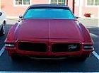
My Omega in the Tuscarora tunnel On the turnpike about 2/3 years ago. https://picasaweb.google.com/1017535...66801407580818
Is this childish?
Is this childish?

Registered User
Joined: Nov 2006
Posts: 1,790
From: McMurray, PA
I have explored a good section of the old abandoned Hwy 101 in Oregon - that is disappearing very quickly. It is one you have to search and scrape for in the forest along the hiking trails.
I did find a big bridge built back in the 30's though.
I took some pics if and can post them if anyone is interested.
I did find a big bridge built back in the 30's though.
I took some pics if and can post them if anyone is interested.
Registered User
Joined: Feb 2008
Posts: 11,798
From: Plano, TX
Okay, here are a few pics...
I do not remember the exact locations of these pics, as there are many places where the old highway 101 runs. All the sections I discovered were on public land along hiking trails and in parks.
These all were mentioned in an Oregon hiking trail book. I just had to go out and find them, and many I did...
First one is a concrete mile marker post. I found several of these, as parts of the hiking trails was ON a section of the old 101. once you scrape away 4" of debris with your boot, the road is there.
Second is a concrete culvert. 101 ran above, right along where the green plants are.
Third is a long wide section more out in the open. This was in the Humboldt Redwoods, leading to the bridge below.
Forth - Hiking a bit further is this bridge, dated 1938. i have a picture of the side view somewhere.
Much of the land around it has erroded and fallen. Soon it will be difficult and risky to actually get onto it. It felt quite eirie when I walked on it, as I thought what if the last part of surrounding land fell when i was on the bridge? Someday, this will all crumble to the gorge below.
Fifth - On a later hike, I found the remains of an old sawmill. The stone foundation to a home was a bit further away.
I do not remember the exact locations of these pics, as there are many places where the old highway 101 runs. All the sections I discovered were on public land along hiking trails and in parks.
These all were mentioned in an Oregon hiking trail book. I just had to go out and find them, and many I did...
First one is a concrete mile marker post. I found several of these, as parts of the hiking trails was ON a section of the old 101. once you scrape away 4" of debris with your boot, the road is there.
Second is a concrete culvert. 101 ran above, right along where the green plants are.
Third is a long wide section more out in the open. This was in the Humboldt Redwoods, leading to the bridge below.
Forth - Hiking a bit further is this bridge, dated 1938. i have a picture of the side view somewhere.
Much of the land around it has erroded and fallen. Soon it will be difficult and risky to actually get onto it. It felt quite eirie when I walked on it, as I thought what if the last part of surrounding land fell when i was on the bridge? Someday, this will all crumble to the gorge below.
Fifth - On a later hike, I found the remains of an old sawmill. The stone foundation to a home was a bit further away.
Registered User
Joined: Mar 2010
Posts: 1,309
From: South-central Pa.
Here's an old post card I bought a few years ago.The tunnel Was just being started for the second time,after being abandoned for 40 or 50 years.I heard a few years ago that if the right of ways that the railroad had secured weren't used in certain amount of time they would be void.So that was one of the reasons the Pike was built.No evidence of this but it makes sense and the railroads were heavily subsidized by the government so that could be how the government got the right of ways.
railguy
Pa Turnpike tunnel 003.jpg
Pa Turnpike tunnel 002.jpg
railguy
Pa Turnpike tunnel 003.jpg
Pa Turnpike tunnel 002.jpg
Registered User
Joined: May 2009
Posts: 1,009
From: Woodland WA
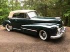
East of Portland Oregon in the Columbia Gorge there are several parts of old Hwy 30 now replaced by I-84. A much better view of the many water falls in the Gorge can be had from old Hwy 30 than from I-84. Also some portions of old Hwy 30 in the Gorge though no longer accessible by car have been made into hiking/biking trails including small tunnels with windows that overlook the Columbia River. It is a great place to go for a day or several in your vintage Oldsmobile. http://en.wikipedia.org/wiki/Histori..._River_Highway.
Jerry
Jerry
Registered User
Joined: Jun 2009
Posts: 15,192
From: southeastern Michigan
Here's another link for the Pennsylvania side of things. Good directions on how to access the various parts of the abandoned Penna TPK.
http://www.briantroutman.com/highway...pike/trip.html
http://www.briantroutman.com/highway...pike/trip.html
Registered User
Joined: Aug 2006
Posts: 3,145
From: Far Northeast Philadelphia, PA
My Omega in the Tuscarora tunnel On the turnpike about 2/3 years ago. https://picasaweb.google.com/1017535...66801407580818
Is this childish?
Is this childish?

Formerly "Shimmer"
Joined: Jul 2011
Posts: 510
From: Lexington, KY
Okay, here are a few pics...
I do not remember the exact locations of these pics, as there are many places where the old highway 101 runs. All the sections I discovered were on public land along hiking trails and in parks.
These all were mentioned in an Oregon hiking trail book. I just had to go out and find them, and many I did...
First one is a concrete mile marker post. I found several of these, as parts of the hiking trails was ON a section of the old 101. once you scrape away 4" of debris with your boot, the road is there.
Second is a concrete culvert. 101 ran above, right along where the green plants are.
Third is a long wide section more out in the open. This was in the Humboldt Redwoods, leading to the bridge below.
Forth - Hiking a bit further is this bridge, dated 1938. i have a picture of the side view somewhere.
Much of the land around it has erroded and fallen. Soon it will be difficult and risky to actually get onto it. It felt quite eirie when I walked on it, as I thought what if the last part of surrounding land fell when i was on the bridge? Someday, this will all crumble to the gorge below.
Fifth - On a later hike, I found the remains of an old sawmill. The stone foundation to a home was a bit further away.
I do not remember the exact locations of these pics, as there are many places where the old highway 101 runs. All the sections I discovered were on public land along hiking trails and in parks.
These all were mentioned in an Oregon hiking trail book. I just had to go out and find them, and many I did...
First one is a concrete mile marker post. I found several of these, as parts of the hiking trails was ON a section of the old 101. once you scrape away 4" of debris with your boot, the road is there.
Second is a concrete culvert. 101 ran above, right along where the green plants are.
Third is a long wide section more out in the open. This was in the Humboldt Redwoods, leading to the bridge below.
Forth - Hiking a bit further is this bridge, dated 1938. i have a picture of the side view somewhere.
Much of the land around it has erroded and fallen. Soon it will be difficult and risky to actually get onto it. It felt quite eirie when I walked on it, as I thought what if the last part of surrounding land fell when i was on the bridge? Someday, this will all crumble to the gorge below.
Fifth - On a later hike, I found the remains of an old sawmill. The stone foundation to a home was a bit further away.
AL

Thread
Thread Starter
Forum
Replies
Last Post


